What's at stake
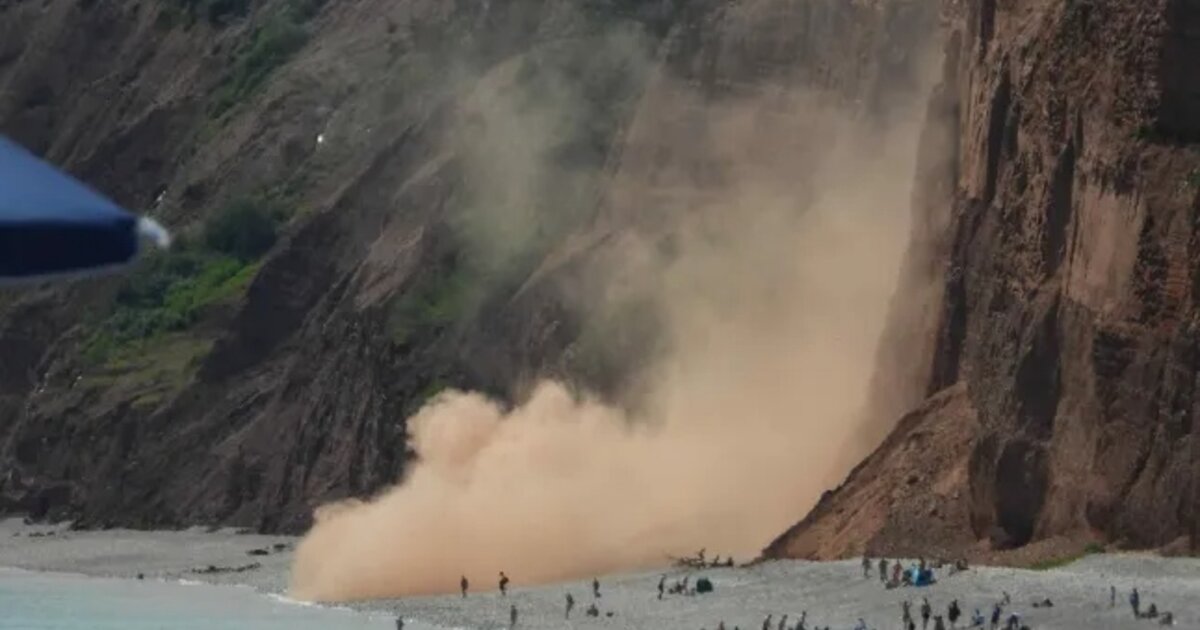
On Tuesday, 12 May 2026, shortly after 1 pm, a roughly 25-metre-wide rock face came loose at Montaña de Gayo in the Risco de Famara and tumbled around 40 metres below the ridge. The cloud of dust and debris was visible from several points across Lanzarote and from the neighbouring island of La Graciosa. No one was hurt, but the Cabildo de Lanzarote closed the Camino de Los Caleteros that evening — the hiking trail that links the beaches of Famara and El Risco.
What happened on Tuesday
The collapse occurred at one of the steepest stretches of the Risco de Famara, in a barely-trodden zone between the Famara and El Risco beaches. Enrique Espinosa, head of the Consorcio de Seguridad y Emergencias de Lanzarote, told local media that the collapse was initially thought to have happened closer to the Mirador del Río — only over the course of the afternoon was the exact location at Montaña de Gayo (known locally as «El Gallo») confirmed.
Since the area is faster to reach from the sea than by land, firefighters from La Graciosa took jet skis to the cliff to check whether hikers or fishermen were in the fall line. Staff from the Cabildo's environmental department and the Haría local police approached by land. By late Tuesday evening, no reports of injuries or missing persons had come in.
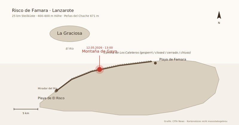
The collapse occurred at Montaña de Gayo, about 40 metres below the ridge. Graphic: CITA News.
The Camino de Los Caleteros
The trail directly affected by the collapse has a particular standing on Lanzarote. The Camino de Los Caleteros runs along the cliff from Famara beach to the Playa de El Risco, a remote cove opposite La Graciosa. Hikers describe it as one of the island's most spectacular routes — and one of its most fragile: older online reports describe sections of trail that have disappeared entirely and crumbling passages where walkers must scramble across exposed rock.
The Cabildo, after consulting with the town halls of Haría and Teguise and the environmental department, decided on a temporary closure Tuesday evening. How long it will last depends on the assessment of geotechnical specialists, whose findings are expected in the coming days.
Why rocks fall at the Risco
The Risco de Famara is 25 kilometres long, between 400 and 600 metres high, and culminates at 671 metres at the Peñas del Chache, Lanzarote's highest point. Geologically, it is the scar of a megaslide that dropped an entire mountain range into the Atlantic 10 to 8 million years ago. What stands today as cliff is the spine of what remained. The UNESCO Geopark Lanzarote y Archipiélago Chinijo lists the Risco as one of its 68 geosites and describes it as stacked basalt lava flows interleaved with pyroclasts, ochre layers and clay strata — a mix in which individual layers weather at different rates.
«The erosion caused by repeated rainfall during the past winter» is the likeliest cause, according to the Consorcio. Lanzarote experienced several unusually wet spells between December 2025 and March 2026 — water seeps into fissures, freezes overnight at higher elevations, and when the material beneath is softer than the basalt slabs above, the slope gives way. In September 2024, a smaller collapse nearby injured a woman walking at Famara beach, who was evacuated by jet ski to Órzola.
What comes next
Over the coming days, Cabildo geotechnicians will assess the collapse zone. Only then will it become clear whether the Camino de Los Caleteros can be reopened or will need to be permanently rerouted. For Lanzarote, the broader question is whether the growing number of hikers in restricted Geopark zones calls for more systematic risk assessment. The Cabildo has not commented on that to date.
For residents and visitors: the Famara and El Risco beaches remain accessible, but the direct trail between them does not. The eastern viewpoints of the Risco — including the Mirador del Río — are unaffected and remain open.
Frequently asked questions
- Where exactly did the cliff collapse happen?
- At Montaña de Gayo, a steep stretch of the Risco de Famara in the municipality of Haría in northwestern Lanzarote. The spot is known locally as «El Gallo».
- How large was the collapse?
- About 25 metres wide, around 40 metres below the ridge. The dust cloud was visible from La Graciosa and several points across Lanzarote.
- Were there any injuries?
- According to the Consorcio de Seguridad y Emergencias, none as of late Tuesday evening. The area is considered very rarely visited.
- Is the Camino de Los Caleteros closed?
- Yes. The Cabildo de Lanzarote temporarily closed the trail between Famara and El Risco on 12 May 2026, pending an expert damage assessment.
- Are the Famara beaches still accessible?
- Yes. The beaches themselves are not affected. Only the trail between Famara and Playa de El Risco is closed.
- Why do rocks keep falling at the Risco?
- The Risco de Famara is the scar of a prehistoric megaslide. Its layered basalt and pyroclastic strata weather at different rates. Sustained rainfall — as in the winter of 2025/2026 — dislodges sections from the slope.