Magnitude 1.4 quake near Agaete: what the data show
Spain's Instituto Geográfico Nacional (IGN) recorded an earthquake of magnitude 1.4 mbLg southeast of Agaete, in the north-west of Gran Canaria, on Sunday 6 September 2026 at 04:47:08 UTC (05:47 Canary time). According to the IGN data reported by Atlántico Hoy, the focus lay one kilometre deep and the institute assigned it a maximum intensity of II. No damage or incidents have been reported.
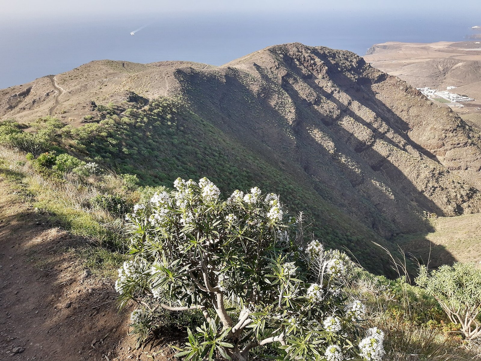
Photo: Gerda Arendt, CC BY-SA 4.0 (Symbolbild).
The most important point belongs at the top: a magnitude of 1.4 is a micro-earthquake. A tremor that size is normally not felt at all, and events of this kind are recorded routinely across the islands. This is not a forecast of anything. Gran Canaria's volcanic traffic light remains at green, the level of normality; there has been no change of level, and neither the IGN nor the Instituto Volcanológico de Canarias (Involcan) has reported any sign of volcanic reactivation on the island. On the published data, the risk is low. What follows is the context that lets you read that number calmly.
What the IGN actually recorded
The entry for the 6 September event is short, and that is its virtue: magnitude 1.4 mbLg, one kilometre deep, epicentre southeast of Agaete, maximum intensity II. Atlántico Hoy, reporting the IGN figures, does not specify whether the epicentre lay onshore or offshore, so neither do we.
The quake does not stand alone. Between Thursday 3 and the early hours of Friday 4 September, the IGN located around ten small earthquakes in and near Agaete, with magnitudes of roughly 0.6 to 2.1 and depths of between 1 and 10 kilometres, as reported by EFE and Canarias7. Two of them were weakly felt by residents, with maximum intensities of II and III: the largest, magnitude 2.1 at six kilometres deep, and another of 1.9 at the same depth. The exact times differ between outlets — one gives 13:11 and 15:16, another 15:11 and 17:16 — most likely because of the gap between UTC and Canary time.
Earlier, on 28 August, the IGN had recorded a magnitude 2.2 quake at Agaete at 05:26 Canary time and about four kilometres deep, which was not felt and caused no incidents, according to RTVC. Canarias7 puts the number of earthquakes located by the IGN in Agaete and its surroundings over the past three months at around twenty.
What a magnitude of 1.4 actually means
Magnitude and intensity are two different things, and confusing them is the commonest source of needless alarm. Magnitude — the IGN uses mbLg for regional earthquakes in Spain — measures the energy released at the focus and is calculated from seismograms. The scale is logarithmic: one unit up means roughly 32 times more energy. Intensity, on the European EMS-98 scale (grades I to XII), measures not energy but effects: what people noticed and what happened to buildings.
With that distinction, the 1.4 places itself. Earthquakes only begin to be perceptible to some people at around magnitude 2.0 to 2.5, and then only if the epicentre is very close; below 2 they are classed as micro-earthquakes, detectable solely by sensitive instruments. Intensity grade II describes a tremor barely perceptible, noticed at most by a few people at rest indoors; grade III a weak shake, comparable to a lorry passing.
One detail explains why tiny tremors have been felt at all in Agaete: depth. A focus one or six kilometres down is practically underfoot, and from that close a small quake can be noticed despite its low magnitude. That does not make it more powerful — only nearer.
How much Gran Canaria shakes in a normal year
The short answer: far more often than most people assume, and almost always without anyone noticing. In its seismicity summary for 2025, the IGN stated that it had located 1,960 earthquakes in the Canary Islands over the year, of which only 18 were felt by the public; the highest magnitude of the year was 3.8, on El Hierro on 29 December. Across all of Spain, mainland included, the IGN counted 7,987 earthquakes in 2025, of which 199 were felt.
Within the archipelago, Gran Canaria is nowhere near the busiest island. Tenerife recorded 740 earthquakes inside the island across the whole of 2025 and, in the single month of July 2026, 641, according to Canarias7 citing the IGN. That is an entirely different order of magnitude.
Agaete, though, has form. On 30 and 31 October 2025, Involcan detected a swarm in north-west Gran Canaria near Agaete, with more than twenty micro-earthquakes, eighteen of whose hypocentres it managed to locate, a maximum magnitude of 1.6 and depths of 0 to 3 kilometres; the IGN noted at the time that at least five were felt in Agaete, Teror and Gáldar. Involcan described that episode as similar to those of the preceding weeks. Put another way: at this point on the map, the past few days are not new.
A note on honesty: the IGN publishes the annual Canary total and the number of felt earthquakes, but it does not release an open, official island-by-island breakdown of those 1,960 events. The per-island figures in circulation come from media tallies, and we do not present them here as official.
Gran Canaria's volcanic status, and who watches it
Gran Canaria is considered geologically active — by the criterion the Canary government applies, every island is except La Gomera, whose last activity is dated to four or five million years ago — but its profile differs sharply from Tenerife's or La Palma's. Since the Castilian conquest in the fifteenth century, some 16 historical eruptions are counted across the archipelago, spread over Lanzarote, Tenerife, El Hierro and La Palma, which accounts for around half. Gran Canaria is not on that list: it has no eruption documented in historical times. The island's most recent known eruption is usually attributed to the Caldera de Bandama and dated to roughly 2,000–3,000 years before present; popular geological sources agree on that order of magnitude, but we could not locate a technical sheet from the IGME or Involcan fixing an exact figure, so we give it as an approximation.
Why, then, does Agaete shake? The explanation the agencies work with points to tectonics, not magma. Coverage of earlier episodes in the same area reported that the IGN suspects a tectonic origin and that these events show "no characteristic linking them to magma in movement or to hydrothermal activity tied to volcanism"; IGN seismologist Eduardo Suárez raised, in remarks reported by Canary media, the hypothesis of a readjustment of the island edifice, since the archipelago sits on a plate across which stresses are redistributed. Involcan and the IGN have described this seismicity as slightly above average, but not anomalous, and as giving no indication of a change in the island's volcanic activity.
The monitoring is not token. In the Canaries the IGN maintains more than a hundred stations, instruments and sampling points — seismometers, GNSS antennas, tiltmeters, cameras and geochemical stations — with the Red Sísmica Nacional operating around the clock and some fifteen people assigned to the work in the Canary office, as El Día reported in July 2026. Involcan contributes its own network within the Red Sísmica Canaria, with around twenty stations on Tenerife alone.
How to read the data yourself, and what would really matter
You do not have to wait for a tremor to reach the press. The IGN publishes its latest-earthquakes map at ign.es, with views of the last 3, 10 or 30 days, giving for each event the time, magnitude, depth, coordinates, maximum intensity and epicentre location. The listing covers events of magnitude 1.5 or above over the last ten days in mainland Spain and the Canaries — plus smaller ones when they have been felt. That rule is why a 1.4 appears at all. The catalogue can be filtered by area, dates, minimum magnitude, depth and intensity, and there is an official IGN app for phones.
The channel runs the other way too: anyone who notices a tremor can fill in the IGN's macroseismic questionnaire on its website and describe what they perceived. Those replies are what allow an event's EMS-98 intensity to be assigned.
And what would genuinely matter? Not a single magnitude 1.4. What the agencies track is the whole picture: a sustained rise in the number and size of events, hypocentres migrating towards the surface, ground deformation measured by GNSS and tiltmeters, and changes in gas emissions such as CO₂ and radon. The formal signal, the one that counts for civil protection, is a change in the volcanic traffic light. That decision rests with the director of PEVOLCA — the Canary government's Dirección General de Emergencias — advised by the scientific committee and the advisory committee, and it is announced publicly. Gran Canaria stands at green today; in the archipelago only La Palma remains at yellow, because of the monitoring that followed the Tajogaite eruption.
Go to ign.es, open the latest-earthquakes section and filter for the Canaries: you will see almost in real time every event with its magnitude, depth and intensity. If you felt a tremor, fill in the IGN's macroseismic questionnaire — your answer helps establish the event's real intensity. For volcanic monitoring, the IGN and Involcan are the official sources; the traffic-light level is announced by the Canary government.
Magnitudes shown on international earthquake aggregators are preliminary and are frequently revised; for the Canaries the reference is the IGN. On this particular September series at Agaete the IGN has published catalogue data, not an interpretive report: any categorical claim that it is "volcanic" or "purely tectonic" goes beyond what has been published about these events. Treat unsourced maps, screenshots and videos circulating on social media, which read intent into a micro-earthquake, with scepticism.
The figures, in short
- The event: 6 September 2026, 04:47:08 UTC (05:47 Canary time), magnitude 1.4 mbLg, 1 km deep, southeast of Agaete, maximum intensity II, no damage (IGN, via Atlántico Hoy).
- The preceding series: around ten earthquakes between 3 and 4 September, magnitudes 0.6 to 2.1, depths of 1 to 10 km, two weakly felt at intensities II and III (IGN, via EFE and Canarias7).
- The recent precedent: magnitude 2.2 on 28 August at 4 km depth, not felt (IGN, via RTVC); around twenty quakes at Agaete in three months (Canarias7).
- The annual context: 1,960 earthquakes located in the Canaries in 2025, of which 18 were felt; maximum magnitude 3.8 on El Hierro on 29 December (IGN).
- The comparison: Tenerife totalled 740 earthquakes in all of 2025 and 641 in July 2026 alone (IGN, via Canarias7).
- The status: Gran Canaria's volcanic traffic light is green; the island has no eruption documented in historical times, against some 16 across the archipelago since the fifteenth century.
FAQ
- Was the magnitude 1.4 earthquake felt?
- The IGN assigned it a maximum intensity of II, the grade for a tremor barely perceptible and noticed at most by a few people at rest indoors. The published information records no damage. Two larger quakes in the series a few days earlier, of magnitudes 2.1 and 1.9, were weakly felt.
- Is this a warning of an eruption on Gran Canaria?
- Nothing published supports that. The island's volcanic traffic light remains at green and has not been changed, and in earlier episodes in the same area the IGN said these quakes show no characteristics linking them to magma in movement. Involcan and the IGN have described the seismicity as slightly above average, but not anomalous.
- Why Agaete in particular?
- The explanation the agencies use is tectonic: stresses readjusting underground in an old volcanic edifice crossed by faults. IGN seismologist Eduardo Suárez raised, in remarks reported by Canary media, the hypothesis of a readjustment of the island edifice. The area sees recurring episodes: there was already a swarm there in October 2025.
- When did Gran Canaria last erupt?
- No eruption is documented in historical times, that is, since the Castilian conquest of the fifteenth century. The island's most recent known eruption is usually attributed to the Caldera de Bandama, roughly 2,000 to 3,000 years before present — an approximation repeated in the geological literature that should be read as an order of magnitude.
- Where can I see the official data myself?
- On the IGN website, ign.es, in the latest-earthquakes section and in the catalogue, which can be filtered by area, dates, magnitude, depth and intensity. The IGN also offers an official mobile app and a macroseismic questionnaire in which anyone who felt a tremor can describe it.
Read on
- Fuerteventura: 3.0 quake near Pájara on 2 OctoberFuerteventura · 3 October
- Gran Canaria: Braulio free concert on 25 OctoberGran Canaria · 22 October
- Valsequillo fair, 31 Oct–1 Nov: 80 producers, free entryGran Canaria · 22 October
- Gran Canaria: 9 free WOMEX concerts, 22–24 OctoberGran Canaria · 22 October
- Canaries: 26,332 workers fall into poverty after paying rentGran Canaria · 22 October
- All events on Gran Canaria →