How do I get to Fuerteventura?
Aena publishes official flight and terminal information on its website.
Ferry connections include Corralejo to Playa Blanca on Lanzarote and Morro Jable to Las Palmas de Gran Canaria. Timetables and prices change seasonally; the operators Fred. Olsen Express and Naviera Armas are authoritative.
The island bus network is mainly operated by Tiadhe. The company publishes routes, stops and fares on tiadhe.com.
A hire car makes it easier to reach remote beaches and natural areas. On unpaved tracks, the rental company's terms and conditions apply.
Which towns and sights are worth visiting?
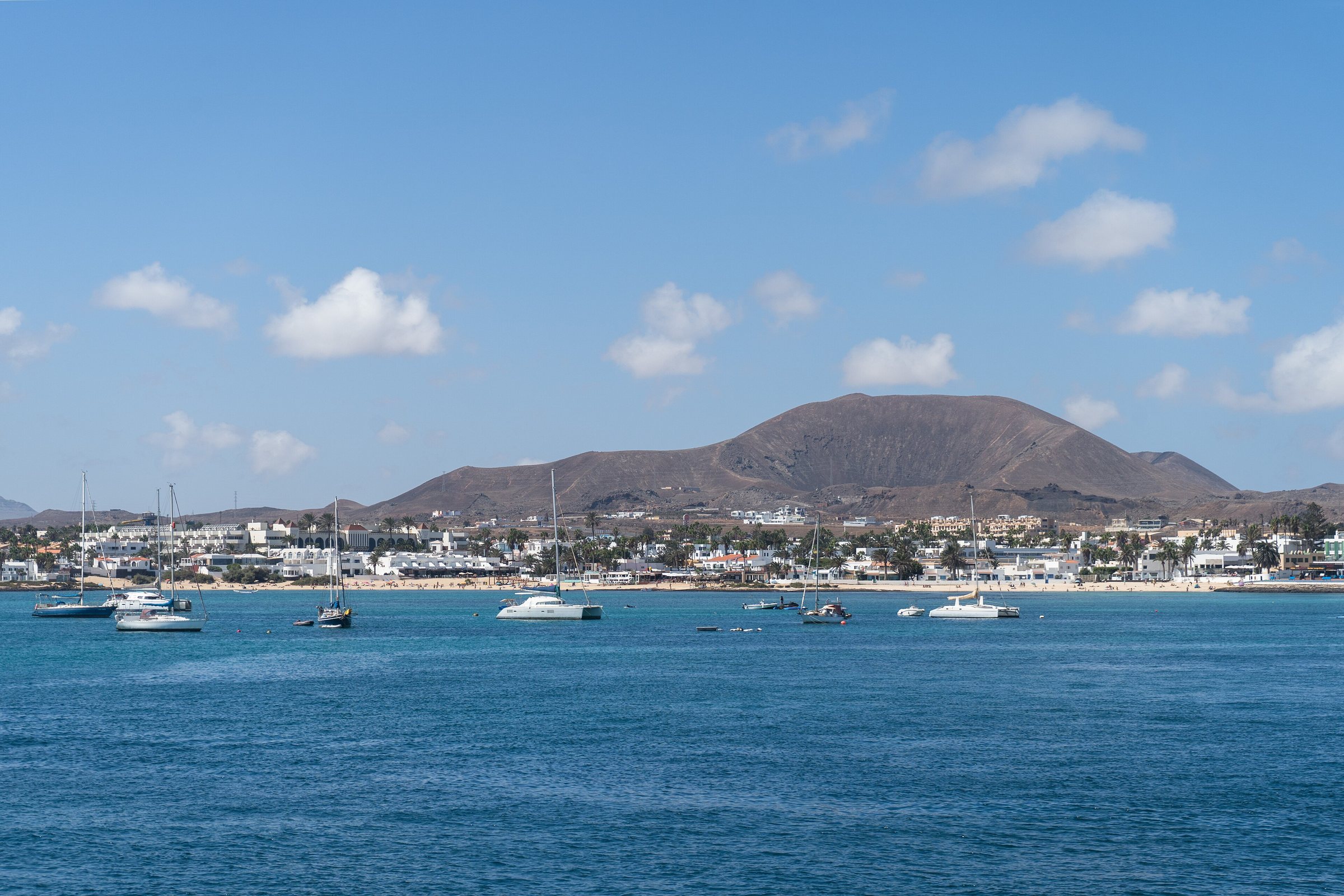
Puerto del Rosario is the capital and the island's ferry port. Corralejo in the north offers access to the dunes and beaches of the Parque Natural de Corralejo.
El Cotillo in the northwest has sheltered bathing coves and stronger surf on the open coast. Lajares serves as a starting point for walks and excursions in the north.
Caleta de Fuste lies close to the airport and has a sheltered bay. Gran Tarajal is a port and coastal town on the east coast.
Morro Jable and Jandía form the holiday region in the south; nearby beaches are among the island's best known. Betancuria is the historic town in the interior and the former capital of Fuerteventura.
Ajuy has a black sand beach and striking rock and cave formations. Particular care is needed when bathing because of surf and currents.
Isla de Lobos is a protected natural area off Corralejo. Access is quota-controlled and requires a prior permit.
When is the best time to visit Fuerteventura?
The following values come from the AEMET climate normals for the Fuerteventura Aeropuerto station for the period 1981–2010. They are monthly averages and not a forecast.
The coolest months are January and February, with daytime maxima of 20.6 °C and 21.0 °C.
Most precipitation falls in December, with 26 mm and 3.2 rainy days. From June to August, AEMET records an average of 0 mm precipitation.
The trade wind is particularly regular on the east and north coasts and is important for windsurfing, kitesurfing and sailing. Calima episodes with Saharan dust can reduce visibility and raise temperatures.
AEMET publishes monthly averages for Fuerteventura, not the sea temperature. A reliable monthly sea temperature table should therefore only be used with an explicitly stated measurement series and measurement period.
What rules apply in the protected areas?
Special rules apply in natural parks and other protected areas. Usually prohibited or restricted are leaving marked paths, damaging plants, collecting rocks, leaving litter, uncontrolled camping and driving on closed areas.
In the Parque Natural de Corralejo and the Parque Natural de Jandía, only designated access routes and parking areas should be used. Do not enter the dunes away from permitted paths, in order to protect vegetation and sand dynamics.
An access permit is required for Isla de Lobos; daily visitor capacity is limited. Do not feed animals and do not remove shells, stones or plants from protected areas.
When walking, carry sufficient water, sun protection and sturdy footwear. Shade is limited on many open sections.
What do I need to know about safety?
Observe flags on lifeguarded beaches; do not swim when the red flag is flying. Strong surf and rip currents can occur on the west coast, on open beaches and near rocky cliffs.
In strong winds, take account of blowing sand, loose objects and more difficult conditions for cycling or walking. Take heat and UV exposure seriously even when the sky is cloudy.
According to the official tourism service, Fuerteventura is the oldest and most sparsely populated of the seven main islands.
Ajuy contains the oldest exposed rocks in the Canaries: marine sedimentary formations aged around 100–150 million years.
What alternatives are there to a pure beach holiday?
A rural and cultural route leads through Betancuria, La Oliva, the Casa de los Coroneles, the Ecomuseum of La Alcogida and traditional villages. A geological route includes the caves of Ajuy, fossil dunes, lime kilns and the Barranco de las Peñitas.
For an active holiday, the island's hiking network offers around 255 km of prepared routes. Birdwatching is possible around El Jarde and in protected coastal areas; the island is home to species such as the houbara bustard and the guirre.
As alternative bases, Corralejo suits restaurants, surfing and access to Lanzarote, Costa Calma or Jandía suit beaches and water sports, and villages in the interior suit peace and rural accommodation.
The UNESCO Biosphere Reserve was designated in 2009, but I have not checked this against a source. Official tourism information names thirteen protected areas and highlights sensitive steppe bird habitats, marine species and endemic flora.