
Why Gran Canaria belongs on a hiker's list
Gran Canaria is the third-largest Canary Island, but the one with the highest density of waymarked trails per square kilometre. Over 300 kilometres of marked paths, mostly on old Caminos Reales — royal roads that linked mountain and coastal villages from medieval times until roads arrived. The paths are dry-stone masonry on dry-stone masonry, some over 500 years old and still solid enough to walk on today.
The island is at the same time a UNESCO Biosphere Reserve (47 % of the surface area) and, since 2019, a UNESCO World Heritage site, «Risco Caído and the Sacred Mountains» — a protection that covers exactly the region around Roque Nublo. Anyone hiking here walks through protected landscape with Canary pines, tabaibal-cardonal shrubland and, at higher elevations, even remnants of subtropical laurisilva.
The elevation range makes the difference: Maspalomas is at sea level, Pico de las Nieves reaches 1,949 m. Over 30 kilometres as the crow flies between southern beach and island peak, you cross three climate zones. That's why the island stays hike-worthy even in August — provided you start early enough and head for altitude.
Roque Nublo — step-by-step instructions
Roque Nublo is Gran Canaria's icon. An 80-metre volcanic monolith, formed 4.5 million years ago in an explosion, sitting at 1,813 metres. Before becoming a tourist attraction it was the Guanche aborigines' sacred place. The shortest trail (S-70) is 1.5 kilometres from the Goleta car park, around 150 m of elevation, about an hour round trip. But access has changed since February 2025 in ways most online guides have yet to update.
The old car park at Degollada de La Goleta right at the trailhead is permanently closed. The Cabildo de Gran Canaria has dismantled it to contain the damage caused by over 300,000 hikers per year. If you come by car, today you park at one of two central points:
Cruz de Los Llanos is the closest option (5 km from the trail, at the junction of GC-600 and GC-150 above Ayacata). From the car park, either walk to the trailhead (3.7 km, around an hour, gentle climb through pine forest) or take the Line 18 shuttle in 10 minutes for €1.40.
Tejeda town centre (15 km from the trail) is the second option. More parking spaces, but a longer shuttle ride (around 30 min). Worth it if Tejeda is on the day's list anyway for the almond sweets.
Roadside parking along the GC-600 along the route is forbidden, marked by signs and ground paint. The Guardia Civil patrols systematically. Fines €150–600, depending on severity.
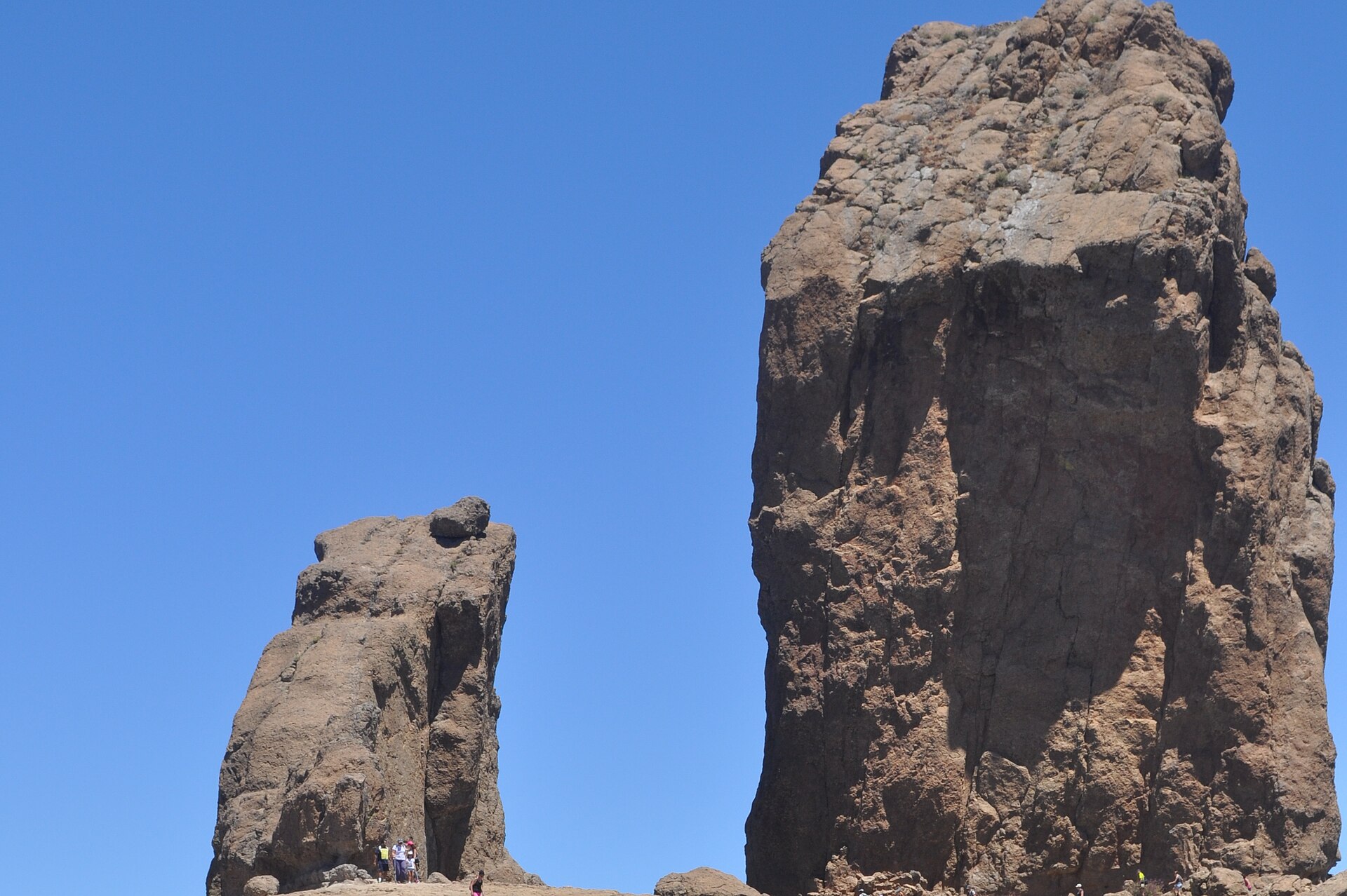
Roque Nublo, an 80-metre volcanic monolith at 1,813 metres altitude, landmark of the central highlands. Photo: Paloma Montoto / Wikimedia Commons (CC BY-SA 3.0 ES).
Reservation and shuttle Line 18
Since 3 February 2025, the Roque Nublo trail has required booking during main opening hours. Booking is free, made at reservasroquenublo.com, and each hiker can apply for up to five permits (for accompanying people).
When the booking requirement applies: 9:00 to 17:00. Outside those hours (before 9 or after 17) access is free, subject to capacity. Anyone wanting to catch sunrise can therefore start early without a booking — but must pass through the access point before 9:00 (Goleta is 5 km from Cruz de Los Llanos).
How the system works: select date, one-hour slot, number of people. After booking a QR code arrives by email. It's scanned at the entrance at Degollada de La Goleta. Maximum 60 people per hour. No-shows get a one-month suspension on further bookings.
Shuttle Line 18: Global runs a loop with five new hybrid buses (80 passengers each). The bus stops at Tejeda, Cruz de Tejeda, Degollada de Becerra, Cruz de Los Llanos, Degollada de Goleta (trailhead!), Ayacata, back to Tejeda. Frequency every 30 minutes 9:30–18:00. Standard fare €1.40 per trip from Cruz de Los Llanos.
Direct from the south: Line 18 runs from Faro de Maspalomas three times a day direct to the Roque Nublo trailhead (via Campo Internacional and San Fernando). Departures Faro de Maspalomas: 8:00, 9:00, 15:00. Returns from Goleta: 11:00, 13:30, 18:00. Price €6 per person. The practical tip: if you're travelling without a rental car, take this direct bus.
Pico de las Nieves and Cruz de Tejeda
Right after Roque Nublo, it's worth stopping at Pico de las Nieves — at 1,949 m the highest point of Gran Canaria. Unlike Roque Nublo, an asphalt road leads directly to the viewpoint, parking on site, no hiking required. On clear days, Mount Teide on Tenerife (3,718 m) appears as a perfect triangle on the horizon. The actively inclined can descend the S-72 towards Roque Nublo from here (around 6 km, 2.5 hours, moderate).
Cruz de Tejeda (1,514 m) is the historic crossroads of the island's paths. Royal roads from all directions meet here. From the small Parador hotel, several classic routes start: a loop to Tejeda via Camino del Sao (5 km, 2 hours, easy), the climb to Roque Nublo (10 km round trip, demanding), the GR131 onwards towards Tamadaba.
Just below Cruz de Tejeda is also the trail to the Cuevas del Caballero — ancient cave dwellings with rock carvings that belong to the UNESCO World Heritage zone. A 3-km hike, easy, worth combining with the Roque Nublo trail or as a standalone day walk.
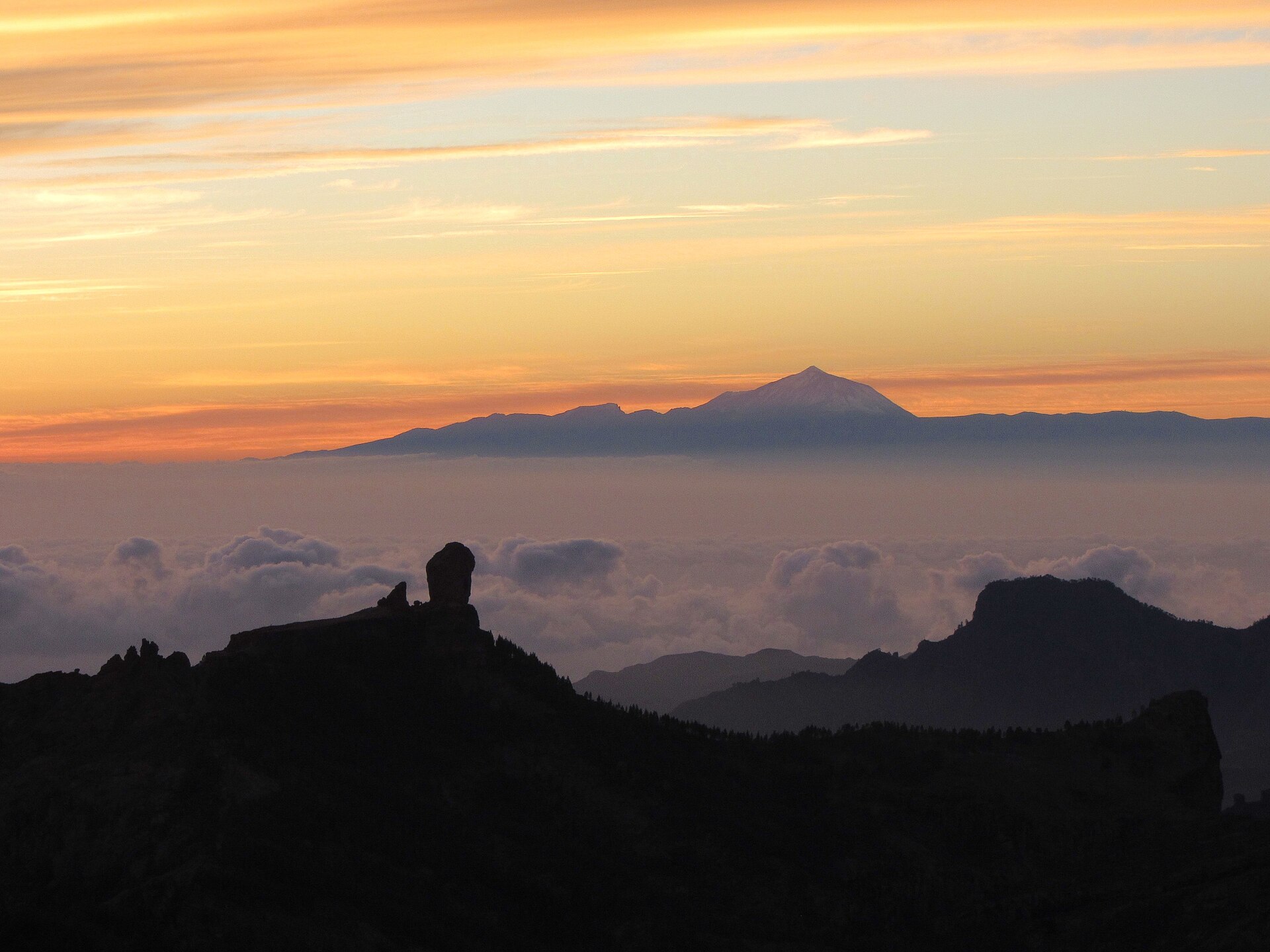
Panorama from Pico de las Nieves at 1,949 metres, with Teide on Tenerife in the background. Photo: Victor R. Ruiz / Wikimedia Commons (CC BY 2.0).
GR131 and Camino de Santiago
If you want not just day hikes but real trekking: GR131 or the parallel Camino de Santiago de Gran Canaria. Both cross the island from south to north, both start at Faro de Maspalomas. GR131 ends at the port of Agaete, the Camino de Santiago at Gáldar. The two routes overlap for the first two stages.
GR131 is 74–90 kilometres long (depending on the source), part of the European long-distance trail E7 that runs from Hungary to Portugal. Recommended staging in 3–5 days:
Stage 1: Faro de Maspalomas → Ayagaures (18 km, 6 h). Urban outskirts, no shade, many take a taxi for the first 10 km.
Stage 2: Ayagaures → Tunte / San Bartolomé de Tirajana (15 km). Here the proper uphill Camino begins, through Barranco de Fataga via Arteara (with its aboriginal necropolis).
Stage 3: Tunte → Cruz de Tejeda (16 km). The famous stage — through Cruz Grande (1,215 m), Paso de La Plata, Ventana del Nublo, Degollada de los Hornos (1,719 m, highest point). Anyone wanting to add the Roque Nublo trail must book in advance.
Stage 4: Cruz de Tejeda → El Hornillo / Tamadaba (16 km). Three reservoirs (Soria, Las Niñas, Chira) along the way.
Stage 5: El Hornillo → Agaete (12 km). Steep descent through Barranco de Agaete, coffee plantations, then the small harbour town of Puerto de Las Nieves with Atlantic pools for tired feet.
Camino de Santiago de Gran Canaria is shorter at 66–67 km, ending in Gáldar at the Church of Santiago de Los Caballeros, where the first mass for Saint James in the Canaries has been celebrated since 1481. Pilgrim's passport available at Faro de Maspalomas, stamp stations along the route. It's the only Camino de Santiago path outside continental Europe.
Where to sleep: no albergue network like the Camino Francés. Stay in hostels, rural B&Bs, occasional hotels. Wild camping is forbidden on Gran Canaria — exception is the Tamadaba Nature Park campsite with free Cabildo registration. Booking link: cabildo.grancanaria.com/zonas-de-acampada.
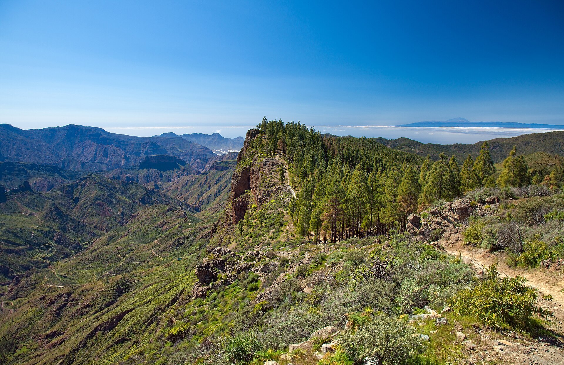
Caminos Reales between Artenara and Cruz de Tejeda — a typical dry-stone trail through the island interior. Photo: Tamara k. / Wikimedia Commons (CC BY-SA 3.0 ES).
Short and medium trails
If you don't want to walk all day, Gran Canaria offers five solid half-day options:
Barranco de los Cernícalos — a 6-km loop through a green ravine with several waterfalls (rarely water-bearing year-round, the best flow comes after wet winters). Trailhead in Valsequillo, about 30 min from Las Palmas. Moderate, around 3 hours, shaded — one of the few trails that stay pleasant in summer.
Tamadaba pine forest — Gran Canaria's largest pine forest. Several waymarked loops from the Tamadaba campsite (1,180 m), 2–8 km, easy to moderate. Views of the western Atlantic from 1,000 m up are spectacular. Even during summer calima often one of the few island options with clean air.
Andén Verde — coastal hike with cliff views between Agaete and La Aldea de San Nicolás. Linear, 4 km, easy. Spectacular sunset trail.
Doramas Forest — last remnants of the subtropical laurisilva that once covered much of the Canaries. Walk from Firgas, easy, with mossy laurel trees, giant lizards, blue chaffinches. Unlike the rest of the island: damp and green.
Cuevas del Caballero from Cruz de Tejeda — as mentioned above, 3 km, easy, with UNESCO World Heritage links.
Gear, season and water
Best season: November to May. Optimal December to March — cool enough at the summits (often 5–10 °C at night), warm enough for T-shirt hiking by day. Very stable weather pattern, little rain. Better avoided in July/August if not strictly necessary — heat and very little shade make longer hikes unpleasant. An acquaintance puts it: «In August in the sierra without shade — you don't hike, you survive.»
Water: there are almost no natural water sources along the trails. Bring at least 2 litres per person per day, 3 in summer. Multi-day GR131 walkers: refill in the next village before each stage. Tunte, Cruz de Tejeda, Tejeda, Agaete all have supermarkets.
Shoes: sturdy trekking shoes, ankle support. Many paths are rough volcanic blocks, brutal in sneakers. Poles help, especially on the steep descent towards Agaete.
Sun protection: sunscreen, hat, the option of long trousers. UV exposure is significantly higher at altitude than at sea. Index 9–11 in summer months.
Maps and apps: Komoot, AllTrails, Mapy all work. Load offline maps before the trail — mobile signal in the cumbres is patchy. The Cicerone guide «Trekking in the Canaries» is the most detailed printed source.
Safety and what doesn't work
Wild camping is officially forbidden on Gran Canaria, except at the designated Tamadaba Nature Park campsite. A 1993 regulation does allow «temporary shelter for people travelling on foot» but isn't interpreted as recreational camping. Fines up to €600. The rule has been enforced more strictly since the 2019 fires.
Roadside parking along the GC-600 between Ayacata and Llanos de la Pez is forbidden and systematically checked. Fines €150–600.
Weather: the main risk is not cold but heat and UV exposure — and in winter the occasional calima, which reduces visibility and breathing at the same time. With storm warnings (download the AEMET app) postpone hikes. The cumbres really can get snow in winter cold snaps (hence «Pico de las Nieves» = peak of snows) — rare, but it happened twice in 2024.
Emergency: 112 Europe-wide. The mountain rescue service (Grupo de Rescate de Montaña) is professionally organised on the island. Solo hikers: share your route with someone, keep your GPS position active.
Frequently asked questions
Frequently asked questions
- Do I need to book for Roque Nublo?
- Yes, from 9 to 17. Free at reservasroquenublo.com, QR code by email. Outside those hours free access, subject to capacity. Maximum 60 people per hour, 1-hour slot.
- Where do I park today to reach Roque Nublo?
- Cruz de Los Llanos (5 km to trail, then 10 min shuttle for €1.40) or Tejeda town centre (15 km, 30 min shuttle). The old car park at the trailhead is permanently closed.
- How do I get to Roque Nublo without a car?
- Line 18 from Faro de Maspalomas direct, 3× daily (8:00, 9:00, 15:00), return 11:00, 13:30, 18:00. €6 per person. Or via Tejeda with a connecting shuttle.
- Which hike at sunrise?
- Roque Nublo before 9 (no booking needed), but the Cruz de Los Llanos car park stays open at night. Alternative: Pico de las Nieves by car directly to the viewpoint — no hiking needed.
- When is the best season?
- November to May, ideal December to March. July/August too hot, little shade on many trails.
- How long for the GR131?
- 3–5 days, depending on pace. Baggage transfer services (The Natural Adventure, Natour, Stingy Nomads) help with logistics. Ferry connection from Agaete to Tenerife available.
- Can I wild-camp in Gran Canaria?
- No, except at the designated Tamadaba campsite. Even there, register with the Cabildo first (free).
- Which app?
- Komoot or AllTrails for offline maps. Load in advance, mobile signal in the cumbres is patchy.
- What about calima during my trip?
- High elevations like Tamadaba and Pico de las Nieves often have better air than the coast. With AEMET warnings (PM10 high) hiking is not recommended, especially with children or respiratory patients.
Image credits
Roque Nublo: photo by Paloma Montoto, Wikimedia Commons, CC BY-SA 3.0 ES.
Caminos Reales Artenara–Cruz de Tejeda: photo by Tamara k., Wikimedia Commons, CC BY-SA 3.0 ES.
Panorama from Pico de las Nieves: photo by Victor R. Ruiz, Wikimedia Commons, CC BY 2.0.